
Brooks Range
The Brooks Range is a remote Arctic mountain range in northern Alaska, extending roughly 600 miles west to east from the Chukchi Sea to the Yukon border.


Brooks Range
Geography
| Continent | North America |
|---|---|
| Region | North Slope |
| Subregion | Alaska |
| Country | United States |
| State | Alaska |
| Latitude | 69 |
| Longitude | -150 |
| Maps |
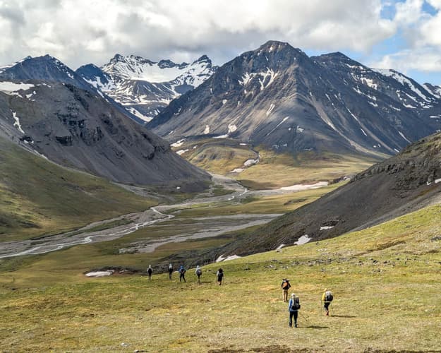
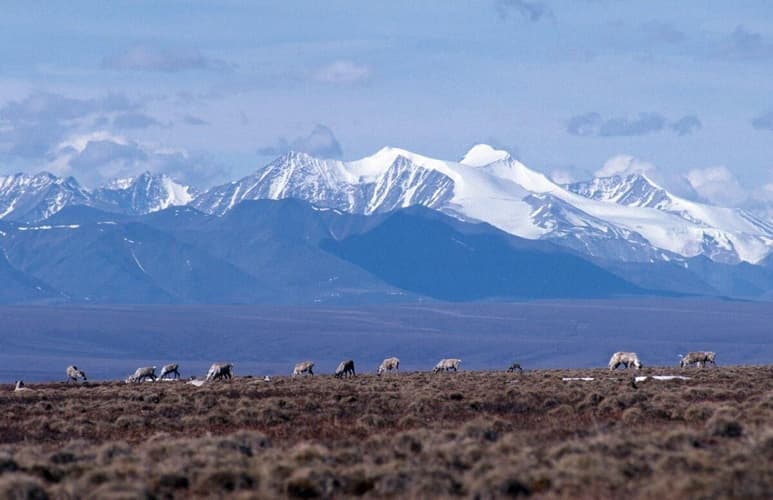
Brooks Range is a rugged, windswept collection of peaks and tundra across northern Alaska. Spanning roughly 600 miles from the Chukchi Sea to the Yukon border, it forms the northern drainage divide between the Arctic Ocean and the Kobuk–Yukon basins. The range’s highest points hover near 9,000 feet, with Atigun Pass offering a rare traversable route through the hills along the Dalton Highway. In the east, Gates of the Arctic National Park and Arctic National Wildlife Refuge cradle vast wildlands where Dall sheep, grizzly bears, and caribou roam; in the west, remote valleys invite backcountry hiking and winter snow adventures. Nearby communities such as Anaktuvuk Pass and Arctic Village serve as gateways for explorers seeking Alaska’s northern wilderness.
Where to Stay
Brooks Range lodging offers remote, air-access stays that serve as jumping-off points to Gates of the Arctic and the Alaskan interior.
Bettles Village sits in the Brooks Range foothills along the Koyukuk River and serves as a jumping-off point for Gates of the Arctic National Park & Preserve, Kobuk Valley National Park, and Noatak National Preserve. Stay at one of two authentic properties: Bettles Lodge (historic Alaska lodging) or the Aurora Lodge (cozy, more modern cabins). Access is primarily by air taxi (or seasonal ice road), and winter trips offer spectacular aurora viewing and guided adventures in the surrounding wilderness.
Coldfoot sits at Mile 175 of the Dalton Highway, the gateway to the Brooks Range and Gates of the Arctic National Park. Coldfoot Camp offers year‑round lodging with a cafe, showers and a range of adventures; nearby Slate Creek Inn serves travelers along the Haul Road. Rates for recreational stays are around $259 per night (2025), with camping options in the summer.
Anaktuvuk Pass sits inside Gates of the Arctic National Park and Preserve in the central Brooks Range. It’s a small Nunamiut village with limited services and lodging at the Nunamiut Corporation Hotel, plus a local cultural highlight at the Simon Paneak Memorial Museum. Visitors typically fly in from Fairbanks and use Anaktuvuk Pass as a gateway to backcountry routes and park experiences.
Map Resources
GAAR Surficial Geologic Map
Surficial geology map of the Gates of the Arctic National Park and Preserve (GAAR) region in the Brooks Range, including a 10-km buffer.
Geologic Brooks Range Plate 1
Plate 1 of the Geologic map of the Brooks Range showing bedrock units and early mapping.
Geologic Brooks Range Plate 2
Plate 2 of the Geologic map of the Brooks Range detailing supplementary geologic data.
Beaufort Sea & Brooks Range Plate 1
Oblique view map of the Beaufort Sea and the Brooks Range (Plate 1) illustrating regional geology.
Central Brooks Range Surficial Data
Geospatial data for the Surficial Geologic Map of the Central Brooks Range, Alaska, including multiple 250k quadrangles.
All content was written by our AI and may contain a few mistakes. We may earn commissions on some links. Last updated: Sun Nov 23, 2025, 7:20 PM